
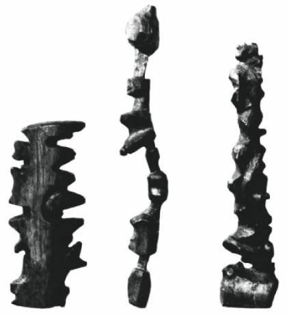
Two years ago, Colleen Morgan of Middle Savagery pointed out these amazing tactile maps of the Inuit, “3D wood carvings of the East Greenland coastline, with the details of inlets and islands in sculptural relief. These could be employed by [travelers] at night in conjunction with the stars, feeling your way along the coastline, navigating at an intimate scale.”
I wonder how tactile maps could be applied to our readings of the city, our apartment, workplace, the transit system...
-Sharon